
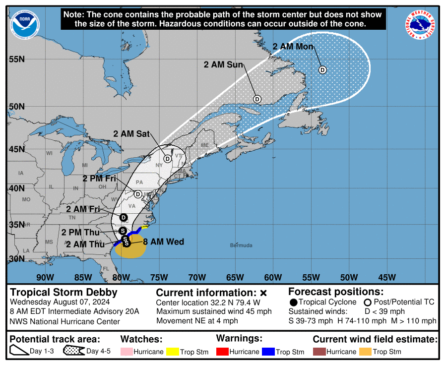
Tropical Storm Debby progress has slowed down and is currently still gaining strength over the western Atlantic. The massive storm now has a more westerly track and will pose a significantly higher flood threat to the Charlotte region.
Early this morning, Debby drifted northeast at 4 mph, positioned 50 miles southeast of Charleston and 90 miles east of Savannah, Georgia, according to the National Hurricane Center.
As of 6:30 PM 8/6: A Flood Watch has been issued along and east of I-77 with 5-8” of rain possible by Friday morning, locally higher amounts possible in the Watch
Area. Heavy rainfall along and east of I-77 is expected late Wednesday through Friday. #scwx #ncwx #cltwx #gawx pic.twitter.com/4c27IdkuoR— NWS GSP (@NWSGSP) August 6, 2024
A second landfall in South Carolina is now expected by Wednesday night or Thursday morning. With sustained winds of 45 mph, forecasters warn Debby could strengthen before hitting the coast.
The storm’s recent westward shift means central North Carolina, particularly the Charlotte area, could see up to 9 inches of rain over the next few days.
Residents should stay weather aware from late tomorrow through Friday, with flooding and downed trees as primary concerns.
NHS officials are reminding all residents in Atlantic Coast states to be prepared for potential future storms.
In case of a power outage, make sure to have the following emergency items stocked in your home;
- Car charger for cell phones and other devices
- Clean drinking water (recommended 1 gallon per person per day, minimum three days)
- Flashlights
- Batteries: Extra batteries for all of your devices
- Weather radio/clock
- Non-perishable food
- First aid kit

