
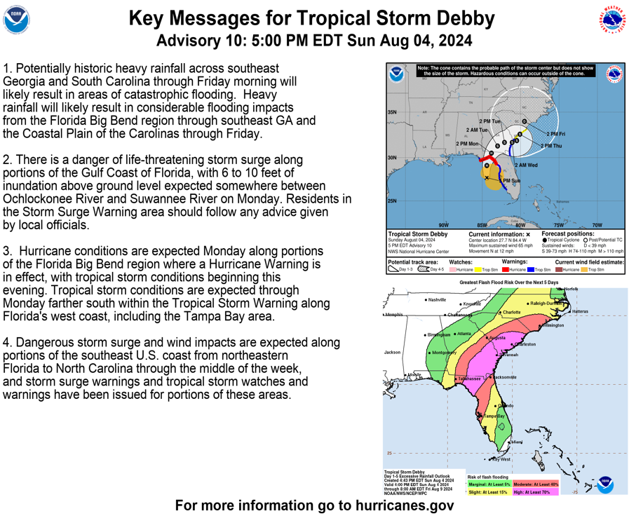
Residents of the Carolinas should prepare for potential impacts from Tropical Storm Debby in the coming days. This storm, the fourth of the 2024 Atlantic hurricane season, is expected to make landfall in northwest Florida on Monday as a Category 1 hurricane.
Expected Path and Impacts
Debby is projected to slow its forward movement Monday night as it moves inland across Florida and Southern Georgia. Widespread flash flooding is highly likely across Southern Georgia and the Carolinas into Monday night and Tuesday.
With a high-pressure system to the west and a cold front to the north, Debby is expected to make landfall in Florida’s Big Bend early Monday. As it moves across the state, it will approach the Georgia and Carolina coastlines. The combination of blocking fronts and distant high-pressure systems could cause Debby to stall out in the region.
Coastal and Inland Effects
Coastal areas in the Carolinas will experience the highest impacts from Debby, including heavy rain, dangerous beach conditions, tropical-storm-force winds, and storm surge. Inland areas, including the Charlotte metro, will also see increased cloud cover and rain bands starting Tuesday afternoon.
Over the next week, inland communities near Charlotte could receive between two and four inches of rain, with higher totals of up to six inches southeast of the metro area. Coastal regions like Savannah, Charleston, Myrtle Beach, Wilmington, and the Outer Banks could see significant rainfall, ranging from seven to over a foot of rain.
NHS officials are reminding all residents in Atlantic Coast states to be prepared for potential future storms.
In case of a power outage, make sure to have the following emergency items stocked in your home;
- Car charger for cell phones and other devices
- Clean drinking water (recommended 1 gallon per person per day, minimum three days)
- Flashlights
- Batteries: Extra batteries for all of your devices
- Weather radio/clock
- Non-perishable food
- First aid kit

