
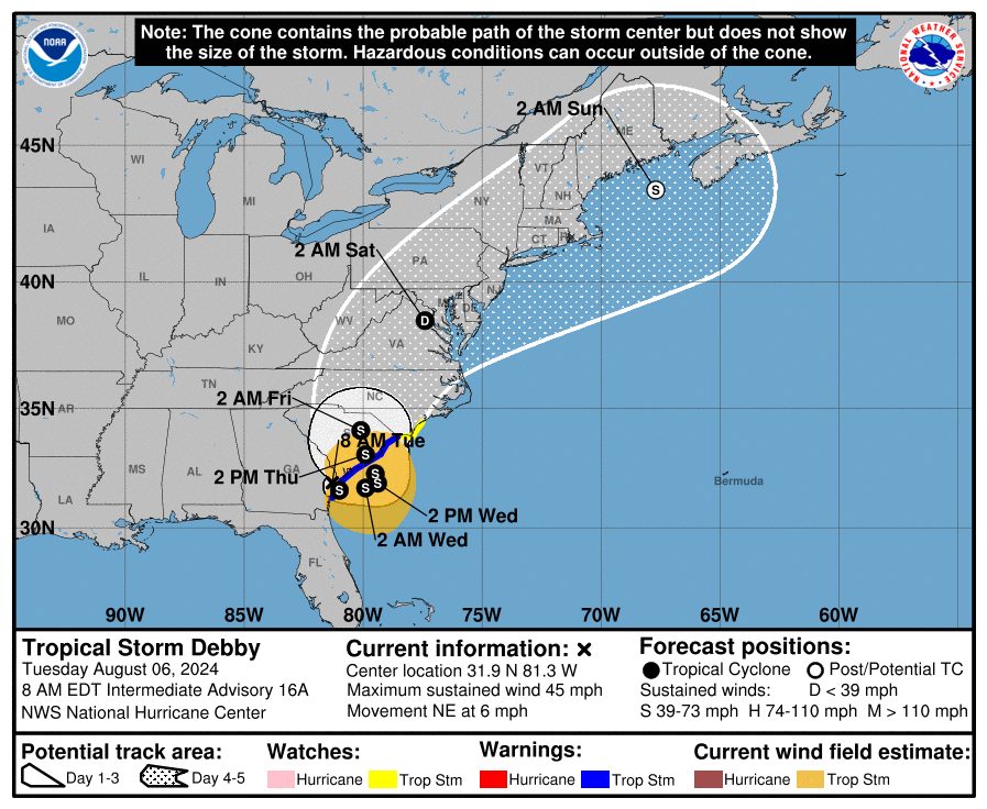
This morning, North Carolina faces multiple watches and warnings as Tropical Storm Debby approaches. As of 8 a.m. Tuesday, Debby is churning over Georgia, moving northeast at about 6 mph, located 20 miles southwest of Savannah and about 105 miles southwest of Charleston.
Tornado and Storm Surge Warnings
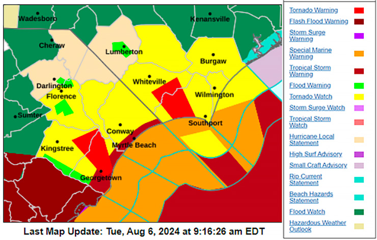
Several tornado warnings and watches are now in effect for Southeastern North Carolina until 5 p.m. Tuesday.
The National Weather Service has also issued a tropical storm watch up to Surf City and a storm surge watch for the coast of Brunswick County. These warnings highlight the significant risks of flash flooding and dangerous storm conditions.
Debby’s Path and Impact
Debby made landfall near Steinhatchee, Florida, on Monday with sustained winds of 80 mph. The storm is expected to move offshore near Georgia’s coast later today, drift there through early Thursday, and then move inland over South Carolina.
Here in the Charlotte area, we could see upwards of 6″ of rain over the next couple of days, causing widespread flash flooding across our region.
Tropical Cyclone Debby is expected to move very slowly over the next couple of days. Please see the latest Advisory graphic from the National Hurricane Center and the expected rainfall for our forecast area below: pic.twitter.com/E5sdyOADyy
— NWS GSP (@NWSGSP) August 6, 2024
NHS officials are reminding all residents in Atlantic Coast states to be prepared for potential future storms.
In case of a power outage, make sure to have the following emergency items stocked in your home;
- Car charger for cell phones and other devices
- Clean drinking water (recommended 1 gallon per person per day, minimum three days)
- Flashlights
- Batteries: Extra batteries for all of your devices
- Weather radio/clock
- Non-perishable food
- First aid kit

